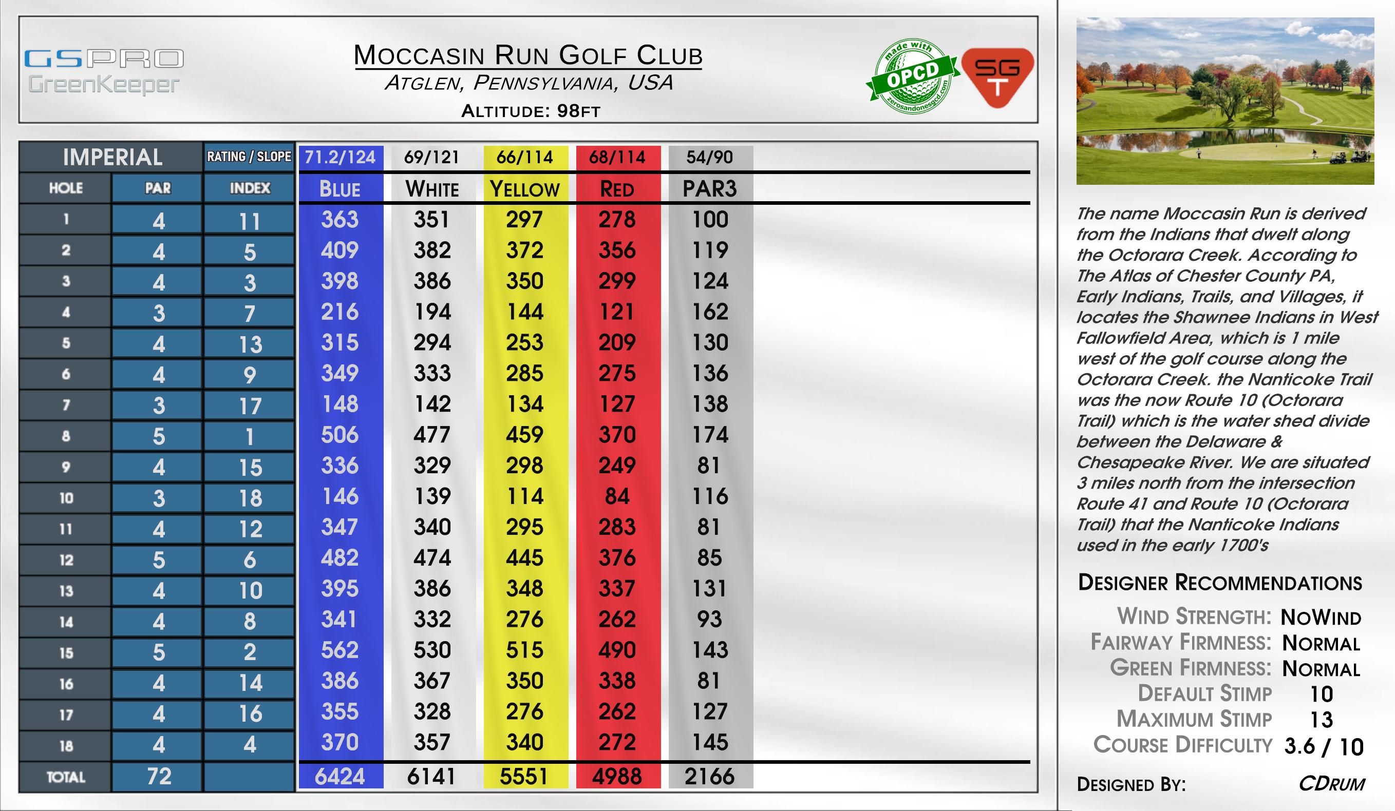
Atglen, Pennsylvania, USA
The name Moccasin Run is derived from the Indians that dwelt along the Octorara Creek. According to The Atlas of Chester County PA, Early Indians, Trails, and Villages, it locates the Shawnee Indians in West Fallowfield Area, which is 1 mile west of the golf course along the Octorara Creek. the Nanticoke Trail was the now Route 10 (Octorara Trail) which is the water shed divide between the Delaware & Chesapeake River. We are situated 3 miles north from the intersection Route 41 and Route 10 (Octorara Trail) that the Nanticoke Indians used in the early 1700's
Wind
No Wind
Fairway Firmness
Normal
Green Firmness
Normal